
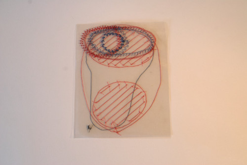
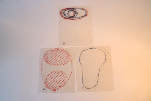
Sensitive maps for categories of space
Project carried out in 2020, during the containment of March / April
According to Georges Perec, in his short reflection “species of spaces”, the page, the bed, the room, the apartment, the building, the street, the district, the city, the countryside, the country, Europe , the world and the universe represent 13 distinct laps of space. The image we have of each one differs according to our sensitive perceptions.
Here are some of my ideas about these places, presented by 13 cards sensitive to changing plastic techniques.
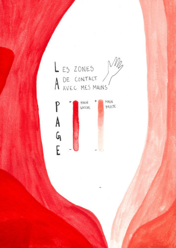
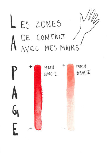
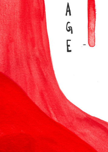
The page
My page map represents the areas of the sheet that I am primarily in contact with when I pick it up. It was made from watercolors.
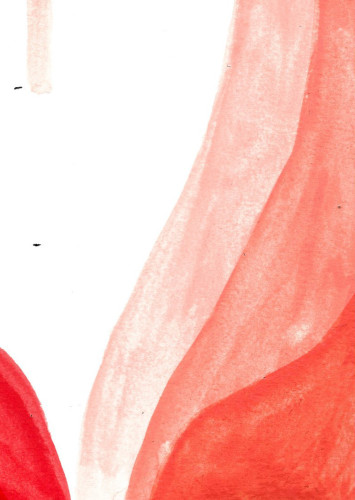
Map photographs
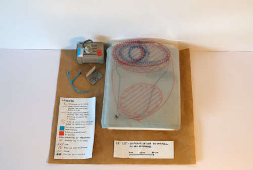
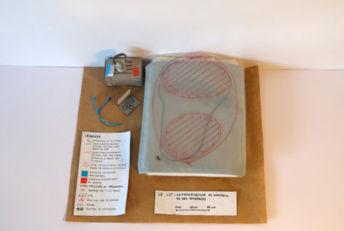
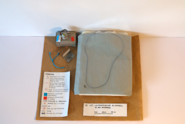
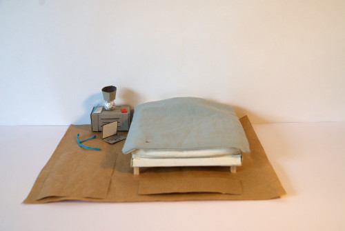
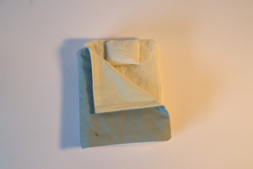
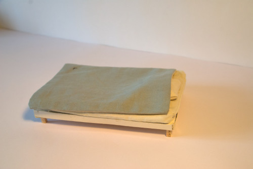
The bed
To map my bed, I reflected on the various actions that I perform within it. It shows 5 main things that I do before sleeping, between reading, writing, checking my phone, watching series and listening to music. These are decisive in how easy it is, or not, to fall asleep after exercise.
This is the phenomenon that I wanted to present in my map, using a system of modular layers, which are superimposed on a model of my bed. This one is made from cardboard glued from developed, papers laminated on cardboard, sewn fabrics and rice to fill my mattress and my pillow. Modular layers are parts of clear cut pockets that I have sewn onto.


Map photographs

The legend of the map
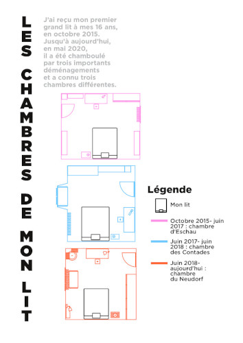
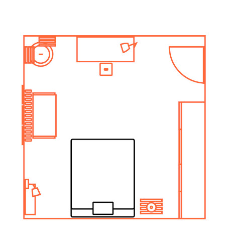
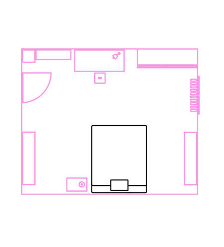
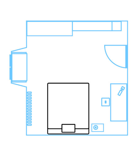
Bedroom
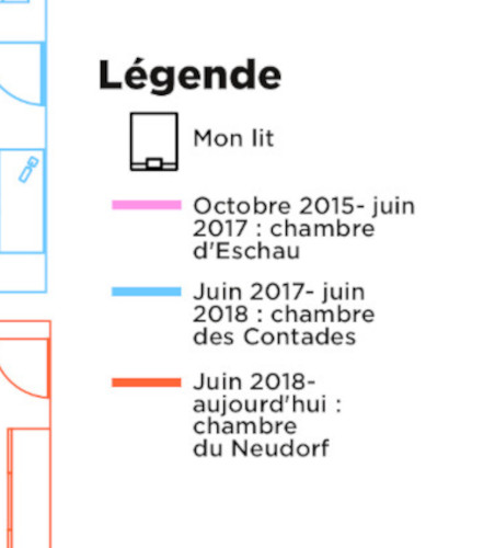
For my room card, I left my bed and the rooms it occupied. I detailed each one in the form of plans, drawn in vector graphics, between my room in Eschau, my room in Contades and my room in Neudorf.
Map photographs
Map photographs
The apartment
The map of my apartment shows the areas where I chat with my roommates. I created it from black markers and paints.
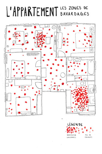
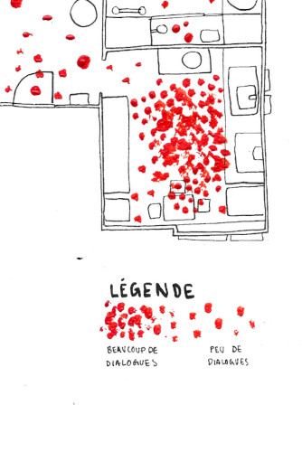
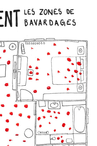
Map photographs
The building
For this map, I made a sound recording in which I describe my building to you.
Sound card of the building
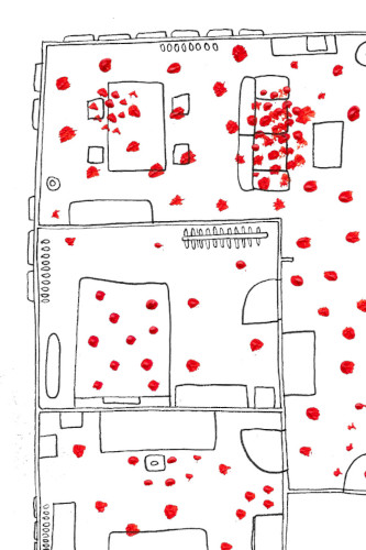
The street
I do not travel much in my street. This is what I wanted to represent in this map, which corresponds to a photograph annotated with the posca.
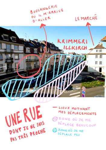
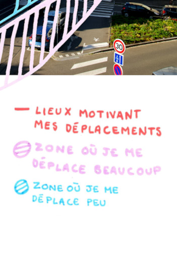
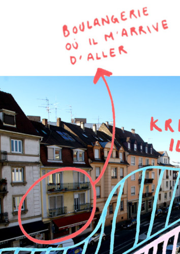
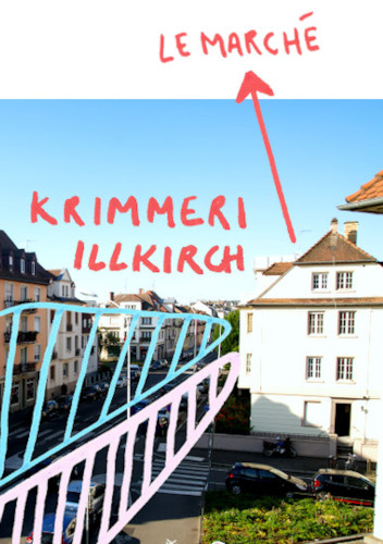
Map photographs
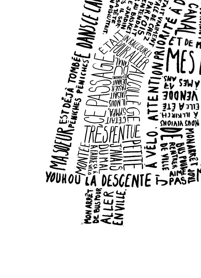
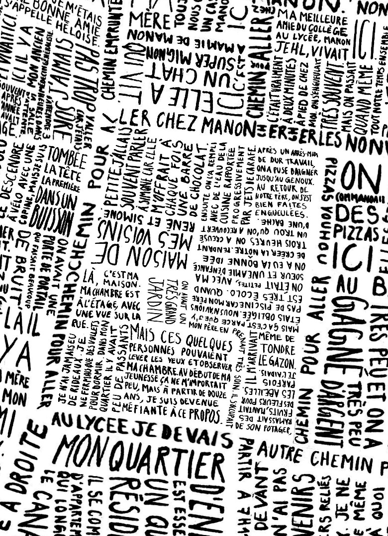
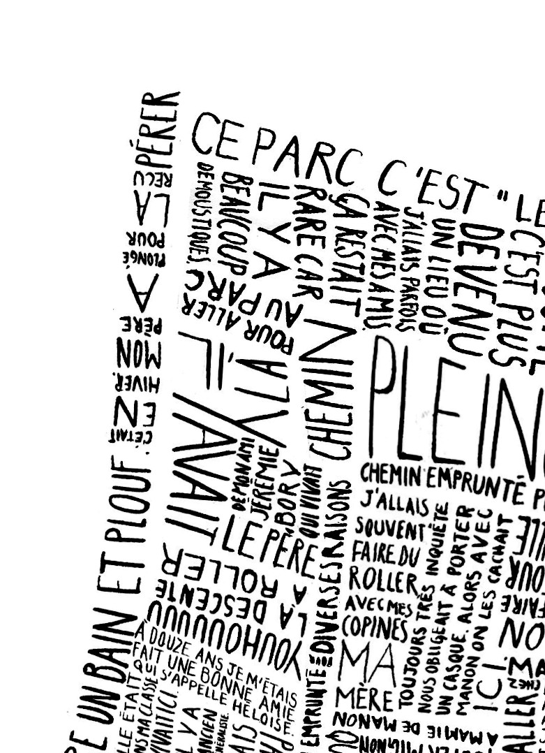
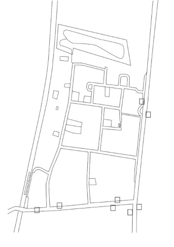
The neighborhood
For this map, I decided to present my childhood neighborhood, in which I haven’t lived since I was 18. This one is drawn from memories written in Indian ink. These are scanned and then located according to a plan of the places seen from above. The final result is printed on an A3 size.

Map photographs
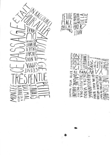
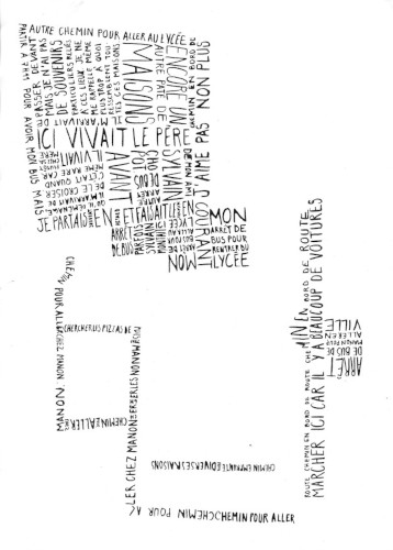
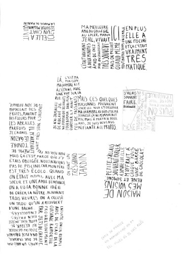
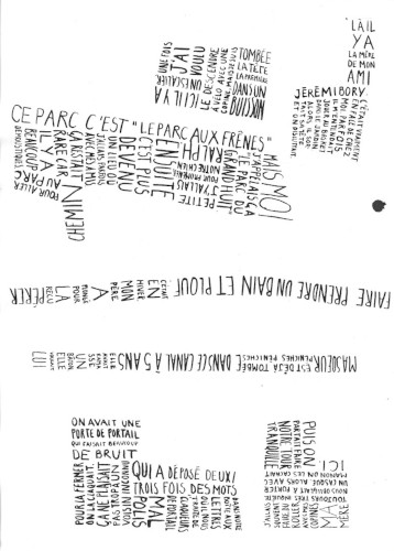
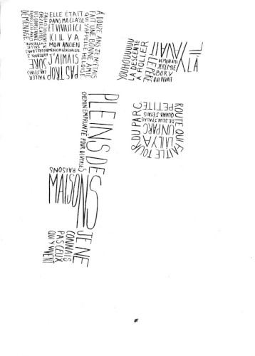
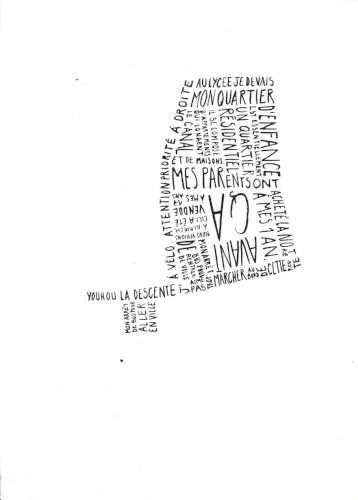
Written memories and the neighborhood map
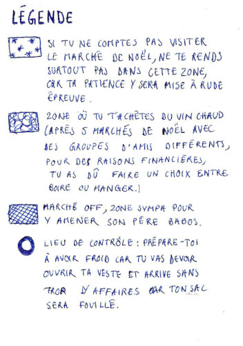
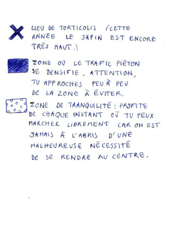
The city
This card represents my perception of Strasbourg during the Christmas market. It is carried out with a bic pen.
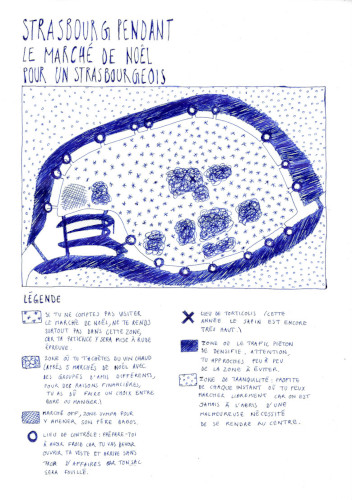
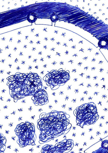
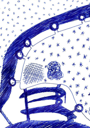
Map photographs
Countryside
I wanted to describe a countryside that I know, which is my father’s house. I have focused this map on all the aspects that make this space light and pleasant, between vegetation, animals or crafts. These are represented by surface figures made from different plastic techniques (greasy chalk, colored pencils, paint, bic pen, etc.).
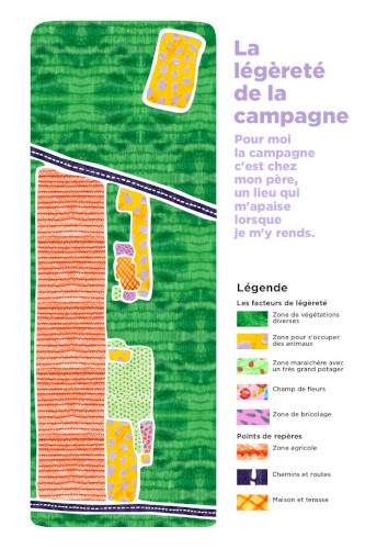

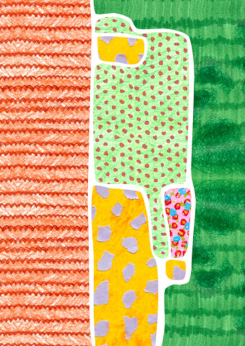
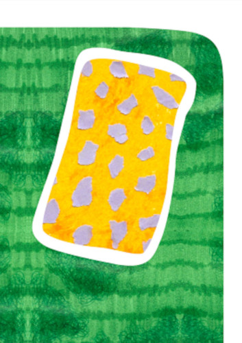
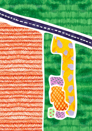
Map photographs
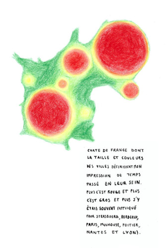
The country
I have represented France according to the cities I have visited the most. I twisted the country to express this phenomenon and create an anamorphic map out of colored pencils.

Map photographs
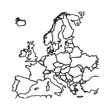
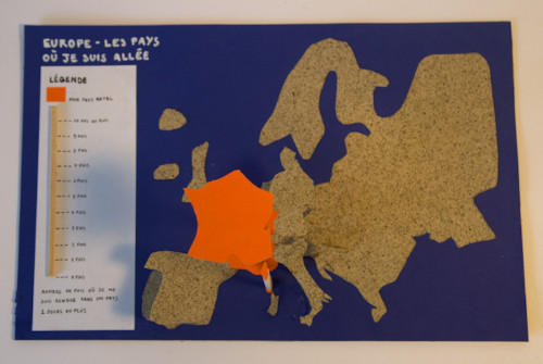
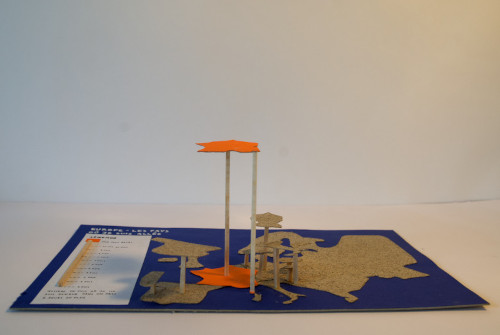
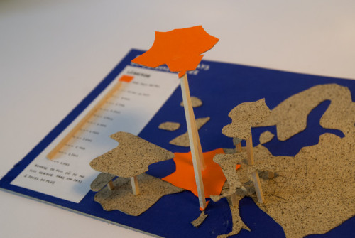
Europe
This map, made using collage, shows Europe according to the number of times I have visited a country.
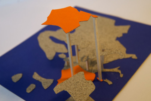
Map photographs
The world
For this map, I embroidered the world on cotton canvas. The beaded parts correspond to the places I would like to visit the most.
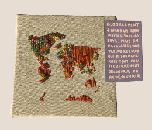

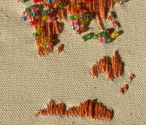
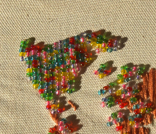
Map photographs
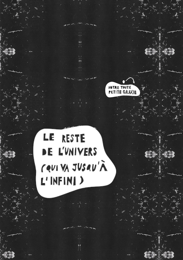
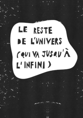
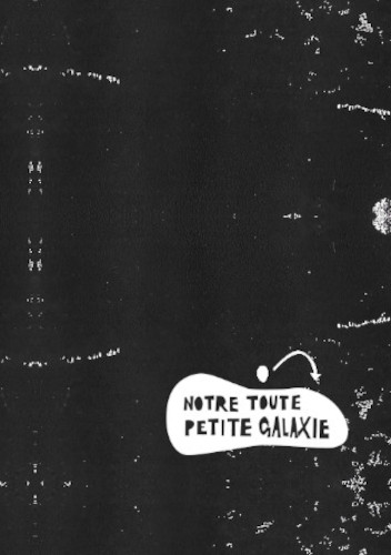
The universe
I wanted to show, through this map, that we are only a tiny part of the universe. To do this, I used the linocut technique.
Map photographs